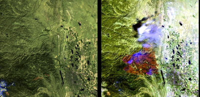
LANDFIRE National used approximately 5,340 Landsat scenes to map CONUS, Alaska and Hawaii. LF continues to rely on Landsat imagery for updates. There were 13,185 scenes processed from 1984-2009 to capture landscape change for CONUS for the LF 2008 update (representing change 1999-2008). Additional years are included because the algorithm used to identify change needed a longer time horizon.
Nearly 5,000 CONUS scenes were processed to create LF 2010 (representing change 2008-2010). The latest update, LF 2012, employed a new image compositing process that used over 20,000 scenes from 2010-2013 in CONUS alone. That is more than 5,000 scenes per year to create composites.


 Latest News
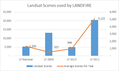 LANDFIRE National used approximately 5,340 Landsat scenes to map CONUS, Alaska and Hawaii. LF continues to rely on Landsat imagery for updates. There were 13,185 scenes processed from 1984-2009 to capture landscape change for CONUS for the LF 2008 update (representing change 1999-2008). Additional years are included because the algorithm used to identify change needed a longer time horizon.