


 Latest News
Henry Bastian, DOI Business Lead
|
Henry Bastian is currently a manager in wildland fire with the Department of the Interior (DOI) in Boise, ID. He oversees and coordinates enterprise systems in vegetation management for the National Fire Plan and Operations System (NFPORS), Interagency Fuels Treatment Decision Support System (IFTDSS), and LF.
Previously, he was the LF business lead in Washington, D.C. He led program performance measures reviews in connection with the DOI Strategic Plan and fire budget justifications, served as chair of the Woody Biomass Utilization Group (Woody BUG - an interagency and intergovernmental group under the National Energy Plan), and was the DOI wildland fire emergency management coordinator for Emergency Support Functions (ESF) under the National Response Framework (NRF). Prior to his LF role, Henry worked as a fire ecologist for the Great Basin and Colorado Plateau National Parks, where he led the fire ecology and fire effects monitoring programs. His experience includes all aspects of fire management from administration, budgeting, operations, and fuels activities. Early in his career, he worked at Bryce Canyon National Park in natural resources, wildlife, biological, and fire management and did non-native vegetation control for the state of Utah. He is a graduate of Snow College and Utah State University with a degree in fish and wildlife biology. He grew up on a dairy farm and enjoys time with family, travel, roller coasters, kayaking, ATV's, fishing, hunting, and other outdoor activities. |  |
Jim Menakis, USDA USFS Business Lead
|
Jim Menakis, Branch Chief for Fire Ecology, Washington Office Fire & Aviation Management (Remote), Forest Service, USDA, Northport, NY, joined LANDFIRE in January 2022.
Prior to accepting the position of Branch Chief, Jim was the National Fire Ecologist for the Forest Service for 12 years. He worked on evaluating the effectiveness of fuel
treatment when tested by wildfire, supporting multi-scale wildfire risk assessments, co-leading the wildfire risk to community’s website ( https://wildfirerisk.org/), and Shared Stewardship outcome metrics pilot projects. From 1990 to 2010 Jim worked at the Rocky Mountain Research Station (RMRS) Missoula Fire Science Laboratory on various research projects relating to fuels and fire ecology, national mapping projects, and applying the best available science to support management needs. Jim received his B.S. in Forestry and M.S. in Environmental Studies from the University of Montana, Missoula.
|
 |
Jon Dewitz, Acting USGS Project Manager
|
Jon Dewitz, Acting LF Program Manager with the U.S. Geological Survey (USGS) at the USGS Earth Resources Observation and Science (EROS) Center.
Jon Dewitz started with the National Land Cover Database (NLCD) in 2001 as the QA/QC lead and external contracting manager for the project. He was promoted to technical lead in 2008 with the USGS, and is currently both the technical and production manager. Over the years he has managed and trained all the members of the NLCD team as well as leading the release and production efforts for all NLCD products (excluding NLCD92). Dewitz has also led efforts to modernize Landcover mapping for the project through virtualization and scripting. These efforts include prototyping and designing the current NLCD and NLCD Shrub (a sister project to NLCD focused on rangeland ecosystems in the western U.S.) processing systems. Dewitz also led all Alaska mapping efforts and was affiliate faculty with the University of Alaska for joint research and mapping efforts. Jon is the CITT and Science branch project representative and the go to for any questions relating to NLCD Publications.
Education and Certifications
BS in Management Information Systems from Augustana College, Sioux Falls, SD The equivalent of a BS in Physics and Biology from North Dakota State University, Fargo, ND |
 |
Jim Smith, TNC LANDFIRE Project Lead
|
Jim Smith, Project Lead for The Nature Conservancy's LF team, acts as a liaison between natural resource professionals, program developers, ecologists, and everyday LF users. He leads targeted, coordinated outreach and analysis efforts to improve conservation outcomes. Jim works at a variety of scales to help LF users ask the right questions, get the best information, and arrive at thoughtful solutions. Besides publishing in peer-reviewed journals, he participates in professional presentations and workshops and provides technical support to the TNC LF Team he leads. Jim has received numerous awards, including awards from the International Spatial Accuracy Research Association, the American Society for Photogrammetry and Remote Sensing, ESRI, and the U.S. Geological Survey. Jim resides in Salem, Virginia.
Awards Received:
|
 |
Marcine Hyser, Task Manager, TSSC Science
| Marcine Hyser is a Task Manager with KBR, Technical Support Services Contract (TSSC) to the U.S. Geological Survey (USGS) Earth Resources Observation and Science (EROS) Center. She has a B.A. in Business Administration and Art from the University of Sioux Falls and has received her Project Management Professional (PMP) from the Project Management Institute. Prior to coming to EROS, Marci supported the financial services industry as a project manager for large- and small-scale projects in both predictive and agile methodologies. She enjoys reading, bicycling, horseback riding, hiking, travel and spending time with family and friends. | 
|
Kori Blankenship, TNC LANDFIRE
| Kori Blankenship, a Certified Fire Ecologist with The Nature Conservancy's (TNC) LF team, combines on the ground experience in forestry and fire with technical expertise in ecological modeling and data science to support conservation and land management efforts across the U.S. Her current projects focus on understanding historical fire regimes, measuring contemporary changes in fire frequency and severity, and quantifying ecosystem conditions. Previously Kori worked at the Missoula Fire Science Laboratory, the Wenatchee National Forest, and Rocky Mountain National Park. Kori earned a Bachelor of Arts and a Master of Science in Geography from Western Washington University. |  |
Sean Beverly, TSSC Science
| Sean is a GIS Analyst with Innovate!, Technical Support Services Contract (TSSC) for the U.S. Geological Survey (USGS) Earth Resources Observation and Science (EROS) Center. He has a B.S. in Earth and Environmental Science from Fitchburg State University in Massachusetts. Sean started as a contractor at the USGS EROS Center working with the Coastal National Elevation Dataset (CoNED) project in 2019 as an analyst before joining LF in 2022. In his free time Sean enjoys running, hiking, and photography. |  |
Paul Bourget, TSSC Science
|
Paul is a GIS remote sensing analyst with KBR, Technical Support Services Contract (TSSC) to the U.S. Geological Survey (USGS) Earth Resources Observation and Science (EROS) Center. Paul received his B.A. degree in geography and anthropology from the University of Southern Maine and a Certificate in GIS. He is a native of Lewiston, Maine. Paul joined the EROS Fire Science Team in December 2014. He currently works on processing LF disturbance data. Other projects Paul has worked on are listed below.
|
 |
Jacob Casey, TSSC Science
| Jacob Casey is a GIS Spatial Data Technician with KBR, Technical Support Services Contract (TSSC) to the U.S. Geological Survey (USGS) Earth Resources Observation and Science (EROS) Center. He has a B.A in geography with an emphasis in GIS and a geology minor from the University of St. Thomas in St. Paul, MN. Jacob started with data management and science departments at EROS in 2011 prior to joining LF in 2017. Jacob enjoys playing/watching sports, any outdoor activities, and riding his Harley-Davidson Motorcycle. |  |
Erica Degaga, TSSC Science
| Erica is a Remote Sensing Scientist with KBR, Technical Support Services Contract (TSSC) to the U.S. Geological Survey (USGS) Earth Resources Observation and Science (EROS) Center. Joining the LF program in 2019, she supports the LF 2016 Remap effort. Erica specializes in GIS, automating processes primarily through Python scripting, and has experience with Lidar and ESRI products. She has a Master's in GIS, a BSc in Geological Engineering, a Minor in International Studies (Cultural Anthropology) from Michigan Technological University, and an ASA in Freshwater Studies (Marine Technologies) through Northwestern Michigan College. Her previous work focused in the Natural Sciences, including: underwater acoustic sonar, seismology, freshwater studies, natural hazards such as Debris Flow modeling, remote sensing technologies/techniques. Prior to coming to EROS, Erica worked as a GIS Analyst on Lidar processing, a GIS specialist consultant within the FEMA - SCAN team, and as a GIS Intern creating a scripting algorithm for processing remote sensing data for water characterization. She has also conducted multiple water research and historical studies within the TDPS watershed system in Peru/Bolivia, South America. When not working, she is most likely going to the gym, cooking, learning Afaan Oromoo, or binging another Asian drama. When given the chance, she loves to dance, read, and spend time with friends and family. |
 |
Megan Dettenmaier, TNC LANDFIRE
| Megan Dettenmaier, the Communications Lead for The Nature Conservancy’s LF team, joined TNC LF in 2020. Using a practical approach to conveying complex LF concepts, she aids in providing communications between everyday LF users and behind the scenes LF staff. Megan uses her knowledge and appreciation of ecology to implement innovative communication strategies to benefit both seasoned LF users and LF beginners. Examples of Megan's work include the informative LF Webinars, LF instructional videos, LF Office Hours, the LF Brief, and LF's growing presence in social media (Twitter @nature_landfire and YouTube @landfirevideo). |  |
Ray Dittmeier, TSSC Science
|
Ray is a senior software engineer with KBR, Technical Support Services Contract (TSSC) to the U.S. Geological Survey (USGS) Earth Resources Observation and Science (EROS) Center. Ray has worked at EROS since 2005, and spent the majority of that time developing software for the LANDSAT and LDCM Image Assessment and Product Generation systems. He has experience supporting software for several science projects. An example of Ray's software support includes processing imagery from the ASTER instrument aboard the NASA's Terra satellite for the Land Processes Distributed Active Archive Center (LP DAAC). Prior to coming to EROS, he worked at Bell Communications Research for 14 years.
Ray has a B.S. in computer science from Loyola University Maryland, a M.S. in computer science from Pennsylvania State University, and a M.C.I.S. in Communication and Information Studies from Rutgers University. He also completed course work toward a M.S. in space studies from the University of North Dakota, emphasizing image processing, remote sensing, and space science. |
 |
Daryn Dockter, TSSC Science
| Daryn is a vegetation scientist with KBR, Technical Support Services Contract (TSSC) for the U.S. Geological Survey (USGS) Earth Resources Observation and Science (EROS) Center. He joined the LF Program in 2016 and supports vegetation mapping and classification. He divides his time between the LF team and supporting the Land Change Monitoring, Assessment, and Projection (LCMAP) initiative.
Daryn earned a bachelor’s degree in biology from Northwestern College in Iowa and a master's of environmental science degree from Taylor University in Indiana. He has a background in plant ecology and vegetation dynamics in response to disturbance. Before coming to EROS, he worked as an environmental consultant and brings experience with field studies in various parts of the country related to wetlands, vegetation, and species habitat; GIS data analysis and quality control; and ecological assessments. In his free time he enjoys jogging and spending time with his family. |
 |
Susan Embrock, TSSC Science
| Susan is senior software engineer with KBR, Technical Support Services Contract (TSSC) to the U.S. Geological Survey (USGS) Earth Resources Observation and Science (EROS) Center. She has a B.S. in mathematics and has worked at EROS since she graduated from South Dakota State University in 1993. Susan helps design and create the website. She enjoys spending time with her family, hiking, and traveling. | 
|
Sarah Hagen, TNC LANDFIRE
| Sarah Hagen, a Spatial Ecologist for The Nature Conservancy's (TNC) LF team and the Illinois Business unit, uses her background in ecology and GIS to support conservation planning, land protection, and land management at multiple scales. Her contributions to LF include combining data sets to best understand the past and current conditions of a landscape, building fire needs assessments, and using LF data to identify the most important places to protect. Sarah has a background in grassland conservation and serves as LF's grasslands expert. With her passion for cartography and accessibility, she thoroughly enjoys creating beautiful and accessible maps for LF users. Sarah serves as co-lead of the WebGIS committee on TNC's organizational Geospatial Council and advises anyone who will listen on the basic principles of Universal Design. Sarah has a B.S. in wildlife ecology, a M.S. in environmental conservation, and a graduate-level certificate in GIS from the University of Wisconsin. She also earned a certificate in climate change and public health from Yale University. |  |
Inga La Puma, USDA USFS LANDFIRE Program Lead, Fire Modeling Institute
|
Inga is a fire scientist with the U.S. Forest Service (USFS). Inga has a PhD in Ecology from Rutgers University. Her research projects have included relating NDVI to carbon flux, quantifying fire suppression edge effects on forest composition, and modeling landscape level disturbances on succession. Inga formerly worked as the science communications director for the North Atlantic Fire Science Exchange concentrating on regional and national efforts to enhance the use of fire science in management.
In her free time, Inga enjoys teaching ballet and hiking with her family. |
 |
Deborah Lissfelt, TSSC Science
| Deborah is a member of the LF Reference Data Team with KBR, Technical Support Services Contract (TSSC) to the U.S. Geological Survey (USGS) Earth Resources Observation and Science (EROS) Center. She has a B.A. in international business and French from James Madison University in Virginia. Deborah joined the LF Reference Data Team in 2004, producing and analyzing GIS and tabular data products, which support LF vegetation, fuel and disturbance mapping efforts. Prior to LF, she worked in the private sector and focused on quality control practices and database management. |  |
Brenda Lundberg, TSSC Science
| Brenda is the LF Reference Data Administrator with KBR, Technical Support Services Contract (TSSC) to the U.S. Geological Survey (USGS) Earth Resources Observation and Science (EROS) Center. She has a M.S. in plant and fire ecology from Western Washington University and a B.A. in environmental biology from Beloit College in Wisconsin. Brenda joined the LF Team in 2004, and is currently the Reference Data Team lead. She orchestrates the yearly data call, manages data contributions, and produces and analyzes GIS and tabular data products which support LF vegetation, fuel and disturbance mapping efforts. Prior to LF, she worked for the U.S. Forest Service (USFS), Missoula Fire Sciences Laboratory as a biological technician where she conducted field research investigating fire effects on invasive plant species. She has also worked for the USFS as a botanist for the Entiat Ranger District on the Okanogan-Wenatchee National Forest in Washington. |  |
Charley Martin, TSSC Science
|
Charley is the LF Fuel Team member with KBR, Technical Support Services Contract (TSSC) to the U.S. Geological Survey (USGS) Earth Resources Observation and Science (EROS) Center. He has been a member of the LF fuels production team for the past thirteen years. The Fuel team is responsible for producing the fuels layers within the LF production system. This production primarily includes, coordinating with other internal production teams to ensure logic and spatial accuracy, coordinating with external partners for input and product accuracy, and quality control of the final fuel products. Charley holds degrees in geography and history from Southern Illinois University and has attended numerous graduate level classes in fire behavior science and ecology with Colorado State and Washington State Universities. He began his fire career on brush disposal and fire crew on the Willamette National Forest in 1981. Some of his work experience includes:
|
 |
Ryan Mccliment, TSSC Science
|
Ryan serves as a Landfire Analyst and Fuels Team member at KBR under the Technical Support Services Contract (TSSC) with the U.S. Geological Survey (USGS) Earth Resources Observation and Science (EROS) Center. He holds a degree from Evergreen State in Olympia WA, with a focus on Physics and Literature.
Ryan primarily functioned as a hotshot and initial attack firefighter for twenty-eight fire seasons, with seventeen spent as a smokejumper. Ryan is qualified as a Division Supervisor and Prescribed Fire Burn Boss. He has detailed into district Fire Management Officer and Forest Fire Planner roles. For the past 15 years, Ryan has actively engaged as a Landfire end-user with Incident Management Teams, fulfilling roles such as Fire Behavior Analyst (FBAN), Long Term Analyst (LTAN), and Strategic Operational Planner (SOPL). He also assisted with regional and national fire analysis and decision support. Early in his career, Ryan would spend the fire season immersed in fire-related work, and then dedicate the rest of the year to contributing to a successful project in Hollywood, CA. He has also functioned as a Geo Physicist on the Plate Boundary Observatory component of the NSF’s EarthScope Project. Presently residing in Bend, OR, Ryan shares his life with his wife and dog and enjoys sports, reading, and outdoor recreation. |
 |
Ithaca Oyler, TSSC Science
| Ithaca Oyler is a Geospatial Cloud Architect with KBR, Technical Support Services Contract (TSSC) to the U.S. Geological Survey (USGS) Earth Resources Observation and Science (EROS) Center. Before joining LANDFIRE Ithaca worked as a data scientist in various applications of agricultural remote sensing and machine learning. Ithaca graduated with a B.S. and M.S in Geology & Geophysics from Missouri University of Science & Technology in 2021. In their free time, Ithaca exercises the right side of their brain with a weekly writer’s group at the local coffee shop and socializes with fellow quilters at a Modern Quilters Guild meeting. Ithaca also enjoys cooking, baking, reading sci-fi and historical fiction, and sewing garments and special dresses for whatever big event is coming up next. |  |
Lucas Porter, TSSC Science
| Lucas Portor is a remote sensing scientist with C2G, Technical Support Services Contract (TSSC) for the U.S. Geological Survey (USGS) Earth Resources Observation and Science (EROS) Center. He holds a M.S. degree in geography with emphasis in GIS and remote sensing and a history minor from South Dakota State University. Lucas joined the LF team in 2017 and currently supports the LF disturbance mapping team. |  |
Seff Propios, TSSC Science
| Sofronio (Seff) Propios is a remote sensing scientist with KBR, Technical Support Service Contract (TSSC) at the U.S. Geological Survey (USGS) Earth Resources Observation and Science (EROS) Center. In 2015, he joined the LF team as a USGS EROS physical science technician intern before transitioning in 2017 to a government contractor position supporting the disturbance mapping team. Seff holds a M.S. degree in geography, B.S. degrees in geography and geoscience, along with a minor in mathematics and a GIS certificate, from the University of Montana. A military veteran, he is a former U.S. Army infantryman, having served during the 2000 Toston-Maudlow Fire in Montana, in addition to a six-month deployment to Bosnia and Herzegovina in 2002. |  |
Tobin Smail, USDA USFS LANDFIRE Science Lead
| Tobin, a fire and fuels specialist with the U.S. Forest Service (USFS), worked on a seasonal fire crew for the Helena National Forest from 1995 to 1999. In 2000 he accepted a fire and fuel co-op position with the USFS until 2004. During that time he started with Logan Hotshots Wasatch-Cache National Forest, and then became a fire and fuels specialist with Lolo National Forest. Tobin graduated in 2001 with a B.S. from the University of Montana in forestry. From 2004 through 2005 Tobin detailed to the Lolo National Forest's Supervisor Office as a fire planner and to the Forest Service Region 1 Regional Office as a fire GIS specialist. Starting in 2005 to 2022, Tobin worked on the LANDFIRE program's fire and fuels team at the USFS Rocky Mountain Research Station (RMRS) Fire Sciences Lab, Missoula, the U.S. Fish and Wildlife Service (USFWS), Portland, and as a government contractor for KBR to the USGS EROS Center Sioux Falls. |  |
Eva Soluk, TSSC Science
| Eva is a science communication specialist and data manager with KBR, Technical Support Services Contract (TSSC) to the U.S. Geological Survey (USGS) Earth Resources Observation and Science (EROS) Center. She has a B.S. in biology, with an emphasis on conservation and biodiversity, and a M.S. in biology from the University of South Dakota. She has experience with disturbance ecology, plant ecology, communication, and GIS mapping. In her free time, Eva enjoys painting, yoga, and spending time with her family. |  |
Randy Swaty, TNC LANDFIRE
| Randy Swaty, an Ecologist for The Nature Conservancy's (TNC) LF team, is also the co-lead of the Conservation Data Lab. His ecological knowledge and programming expertise provide him the opportunity to assist natural resource professionals seeking the best data to support their work. Randy's work has ranged from leading problem-solving and data exploration sessions to supporting mycorrhizal fungi experts in mapping potential fungal communities (see Swaty et al., 2016) to developing a template for forest professionals to follow when preparing for forest certification audits. Randy has published multiple peer-reviewed publications, participates in numerous professional presentations, and enjoys connecting with natural resource professionals and helping them find ways to best leverage the power of LF data to advance and amplify their work. | 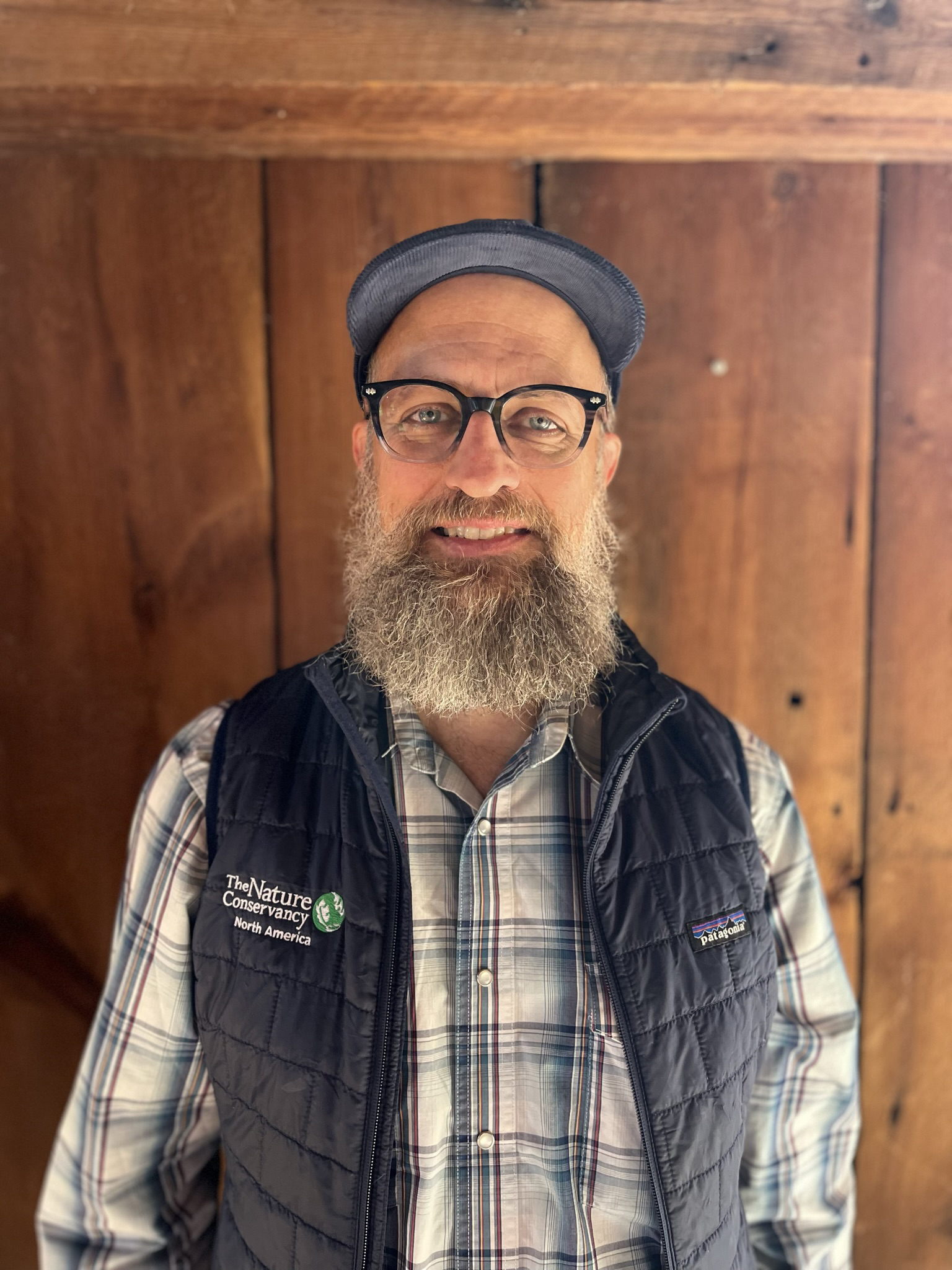 |
Brian Tolk, TSSC Science
| Brian is a senior scientist with KBR, Technical Support Services Contract (TSSC) to the U.S. Geological Survey (USGS) Earth Resources Observation and Science (EROS) Center. He received his M.A. degree in geography from the University of Nebraska-Lincoln emphasizing remote sensing and GIS research and applications. Brian began his career at the Center for Advanced Land Management Information Technologies (CALMIT) in Lincoln, NE as a research coordinator. Towards the turn of the century he moved north to Sioux Falls, SD to work as a senior technical specialist with NASA's Land Processes Distributed Active Archive Center (LP DAAC) at USGS EROS Center. He joined the LF team in 2002 supporting a variety of land cover and disturbance mapping efforts and continues to serve in these capacities. In his free time Brian stays busy coaching youth sports, hunting, fishing, and golfing. |  |


