


 Latest News
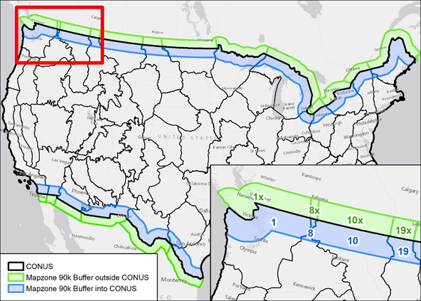
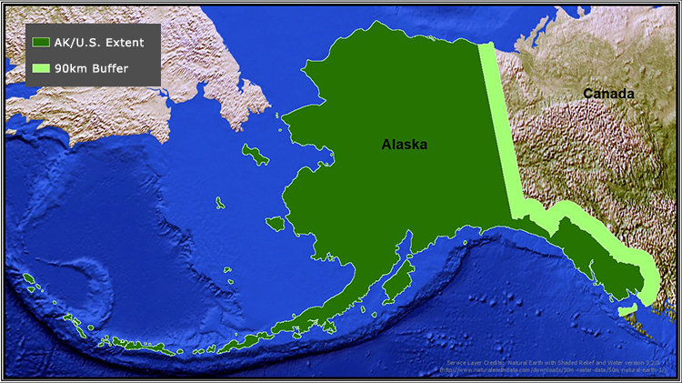
In previous LANDFIRE (LF) versions, LF products had minimal and variable buffer areas ranging from 0 to 3 kilometers (km) beyond the borders of United States (U.S.) lands and territories. Beginning in LF 2016 Remap and continued into all updates since, products for Alaska (AK) and the Conterminous United States (CONUS) are created with a 90km buffer. For AK products, the 90km buffer extends into Canada, then for CONUS the buffer area extends into Mexico in the south and Canada in the north.
These 90km buffer areas support several "on the ground" and analysis needs, such as:
Each version contains unique information about methodology or changes to the 90km buffer areas. Please see the specific version page to learn more about the buffer area for that particulate update.
While the 90km buffer areas are advantageous to some, many users may not wish to include them. For this reason, the AK and CONUS shapefiles, with or without the 90km buffer areas, can be downloaded below. Instructions on how to clip the data can be found (here).
Read more about the importance of cross bordering mapping.
Download zip bundle:
AK and CONUS without 90km buffer


