Pictures of what the LF program incorporates with the LANDFIRE logo on the left and USFS and DOI on the right
LANDFIRE - multi-partner wildland fire, ecosystem, and wildland fuel mapping project USFS DOI
[Skip to Content]
  Button for Who Are We
 
 
Homepage » Data Quality » LF 2010 EVT Agreement Assessment

LF 2010 EVT Agreement Assessment


Data Products:Reference  ∕  Disturbance  ∕  Vegetation  ∕  Fuel  ∕  Fire Regime  ∕  Topographic  ∕  Who are We
     Notifications Alerts

Latest NewsLatest News

Get Data

The LANDFIRE (LF) Program developed agreement assessments for the LF 2010 Existing Vegetation Type product for each LF CONUS GeoArea.* Each GeoArea assessment package includes contingency tables for Ecological Systems and crosswalks to Society of American Foresters-Society for Range Management (SAF-SRM) Cover Type and National Vegetation Classification (NVC) Group. Row agreement tables provide category agreement information for each contingency table. Users are strongly encouraged to review the accompanying ReadMe information to understand the context of this information.

Assessment packages are organized into three products:


in two formats:


*Alaska and Hawaii GeoAreas will be provided when complete.
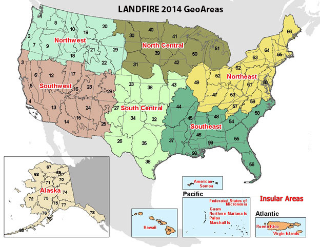
Geoareas 2014

Geoareas:zipped file

North Central GeoArea
Northeast GeoArea
Northwest GeoArea
South Central GeoArea
Southeast GeoArea
Southwest GeoArea


Users may experience intermittent service Thursday evenings due to routine maintenance.
The LF Map Viewer (DDS) will be down every 3rd Wednesday from 8 am - 10:00 am (CDT) for routine maintenance.
URL: https://www.landfire.gov/
To view and print a PDF you must obtain and install the Acrobat® Reader, available at no charge from Adobe Systems.
*DOI and USGS link and privacy policies apply.
Looking for something: Site Map   /   Search
Page Contact Information: LF Helpdesk