


 Latest News
Use keywords to find the FAQ containing the information requested.
If you do not find the question you're looking for, please try the LF Helpdesk Dashboard for more questions from users and their resolutions.
Q. Can I join my attribute table to my multi-band GeoTIFF file I downloaded from LFPS?
LFPS produces multi-band GeoTIFFs which are multi-band floating-point raster datasets. Because raster attribute tables can only be built for single-band integer raster datasets, multi-band GeoTIFFs cannot have an attribute table joined. To remedy this, you can export individual bands from the LFPS output and join with an attribute table.
LF Attribute Tables are in the Comma Separated Value (CSV) format. To find the appropriate .csv file, go to the LANDFIRE Library, select the Comma Separated Value (CSV) link and search for the product .csv you need. Download the .csv file(s) and then follow the steps detailed in the instructions below:
Note: Since these are multi-band GeoTIFFs, drag-and-drop into ArcPro will not work. Users must use the recommended process of clicking on "Add Data" to bring their GeoTIFF into ArcPro.
ArcMap/ArcGIS Pro
As shown in the images below, the categorial information is missing from the multi-band GeoTIFF downloaded from LFPS, but after joining the attribute table to the individual exported raster, the attribute information is present.
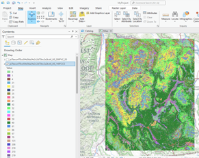 LFPS download legend prior to split of GeoTIFF bands |
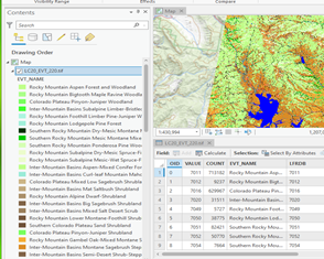 LFPS download legend after joining the attribute table |


