


 Latest News
The LANDFIRE (LF) program is working to increase the frequency of product releases and to reduce the latency of the LF products by producing annual version releases that reflect data less than one year behind current conditions and represent data conditions homologous to the growth that one would expect in areas of change/disturbances up to the year when the products are delivered. To reach this annual update goal, LF is taking several transition steps. The first step in this transition is an update version project called "LF 2019 Limited (LF 2019L)".
LF 2019L products include changes/disturbances that occurred since the completion of LF 2016 Remap, including the years of 2017, 2018, and 2019. The "L" indicates that this is a "Limited" data set, as LF 2019L focuses on updating areas of disturbance for the listed years. Non-disturbed vegetation will be identical to LF Remap.
Released in June of 2021, LF 2019L is built upon the foundation of LF Remap. However, this limited update did not update all the components and is limited in several other significant ways. Understanding the nature of these limitations will help the end user decide if LF 2019L is suitable for their needs and interpret any results the user may derive from modeling or other uses of the data.
 For example, the updates as part of LF 2019L reflect collected or submitted disturbances over a three-year time period from 2017-2019. However, LF 2019L does not include additional remote sensing change detection that was included in previous LF updates.
At the core of the LF 2019L products are ruleset or tables that inform the vegetation and fuel transitions from a disturbance or change. These rules incorporate disturbance type, severity, and time relationships to populate vegetation and fuel data changes for disturbed areas producing updates to vegetation and fuel products.
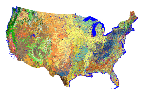
It is important to know that LF 2019L products only cover the Conterminous United States (CONUS) — LF 2019L products for Alaska, Hawaii, and the Insular Areas (OCONUS) will not be produced because the LF 2016 Remap data for the OCONUS areas were not completed when the development of LF 2019L began. Since LF 2016 data serve as the base data upon which updates need to be built, work in these areas could not proceed in parallel. These areas will be incorporated in future updated products once the complete base map of LF 2016 Remap is available.
LF 2019 Limited Resources
LF Updates — LF 2019 Limited White Paper
LF Updates — LF 2019 Limited Executive Summary
LF 2019L Products and Descriptions
LF 2019L products were released in June 2021 and only cover the CONUS — there will be NO OCONUS LF 2019L products produced. See the table to the right for available products.
| Theme | Product Name | Abbreviation |
| Disturbance (2021 Capable) |
Fuel Disturbance | FDistYear |
| Vegetation | Existing Vegetation Cover | EVC |
| Existing Vegetation Height | EVH | |
| Fuel (2021 Capable) |
13 Anderson Fire Behavior Fuel Models | FBFM13 |
| 40 Scott and Burgan Fire Behavior Fuel Models | FBFM40 | |
| 40 Scott and Burgan Fire Behavior Fuel Models Landscape (LCP) | FBFM40 LCP | |
| Forest Canopy Bulk Density | CBD | |
| Forest Canopy Base Height | CBH | |
| Forest Canopy Cover | CC | |
| Forest Canopy Height | CH | |
| Fuel Vegetation Type | FVT | |
| Fuel Vegetation Height | FVH | |
| Fuel Vegetation Cover | FVC |
LF 2019L Disturbance
For LF 2019L, only 2017, 2018 and 2019 disturbances submitted directly to LF or to national databases (FACTS, NFPORS) by December 31, 2019, are included. Fire program data (MTBS, BARC, RAVG) that became available during the production window are also included. No remote sensing change detection methods were used to locate additional disturbances not supplied by other programs or organizations.
LF 2019L Vegetation
Vegetation products for LF 2019L pixels not mapped as disturbed by LF from 2017–2019 will not be different from LF 2016 Remap vegetation— there is NO CHANGE to these vegetation products. Note that this includes LF 2016 Remap pixels with EVT in one of the "Recently Disturbed" categories.
Vegetation products for LF 2019L pixels mapped as disturbed by LF from 2017–2019 have been transitioned to estimate 2021 vegetation cover and height in the LF 2019L version.
Disturbances from 2020 and 2021 are not included in LF 2019L.
LF 2019L Fuels
Fuel products in LF 2019L pixels not mapped as disturbed by LF from 2011–2019 will not be different from LF 2016 Remap fuels — there is NO CHANGE to these fuel products.
Fuel products in LF 2019L pixels mapped as disturbed by LF from 2011–2019 have been transitioned to estimate conditions in 2021. These products will include capable fuels, bringing the data to a 2021 effective condition.
Disturbances from 2020 and 2021 are not included in LF 2019L.
LF 2019L Data Access
Archives


