New improvement in the LANDFIRE 2023 Update: 4 seasons of satellite imagery!
Beginning in the LANDFIRE 2023 Update (LF 2023), disturbance mapping utilizes 4 seasonal composites, doubling our use of satellite imagery.
In the past, only 2 composites were used in disturbance mapping.
New and improved composites are made possible by recent advancements in percentile-based image compositing and additional observations in Harmonized Landsat-Sentinel (HLS) data.
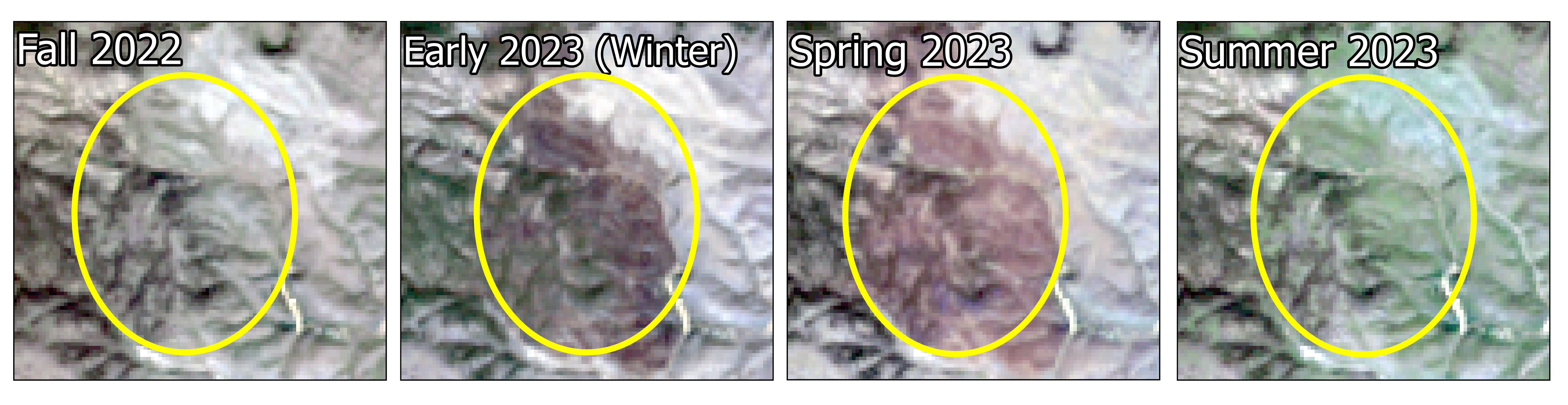
In this example at Elk Mountain in Black Hills, SD you can see how using more satellite imagery makes a difference! This mid-October (2022) fire would not have been captured in LANDFIRE disturbance products as satellite-detected change if not for the use of the 4 seasonal composites.
A fire scar that is visible in the 2023 winter and spring composite, was not visible and identifiable later in the year in the 2023 summer composite due to vegetation greening.


 Latest News