

Product Description
 This page includes a general description of the product, please consult the schedule and version pages for information specific to each release.
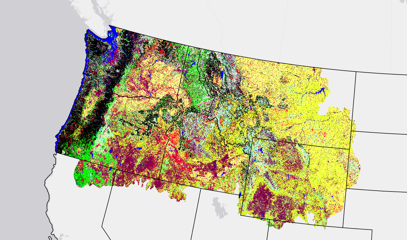
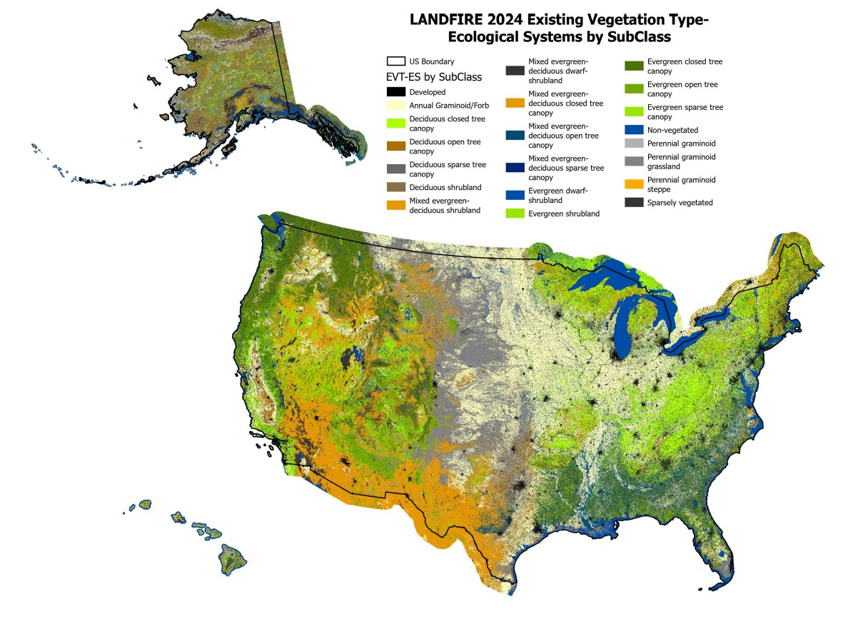
LANDFIRE's (LF) Existing Vegetation Type (EVT-ES) represents the current distribution of the terrestrial ecological systems classification, developed by NatureServe for the western hemisphere, through 2016. A terrestrial ecological system is defined as a group of plant community types (associations) that tend to co-occur within landscapes with similar ecological processes, substrates, and/or environmental gradients.
» provides descriptions for each Ecological System including species, distribution and classification information.
Learn about the history of the Ecological Systems Classification developed by NatureServe
EVT-ES also includes ruderal or semi-natural vegetation types within the U.S. National Vegetation Classification. The LF Ruderal EVT-NVC Groups Descriptions for CONUS provides descriptions for each ruderal EVT-NVC Group including species, distribution, and classification information.
EVT-ES is mapped using decision tree models, field data, Landsat imagery, elevation, and biophysical gradient data.
- Decision tree models are developed separately for each of the three lifeforms—tree, shrub, and herbaceous and are then used to generate lifeform specific EVT-ES layers.
- Disturbance products are included in LF products to describe areas on the landscape that have experienced change within the previous 10-year period.
LF 2016 Remap and beyond includes a 90-kilometer buffer along the 1,500 miles of the eastern and southern borders AK shares with Canada. Then with the LF 2020 update, and future updates, for the Conterminous United States (CONUS) a 90-kilometer buffer into Mexico is also included.
For LF 2016 Remap there was a redesign of the Auto-Keys process, which is used to determine existing vegetation type classification based on plot data in the LANDFIRE Reference Database (LFRDB) — Developing Auto-Keys for LF Vegetation Mapping: 2014-2015 CONUS Project Report
LF uses an assessment process that compares the EVT-ES product for a pixel with the Auto-Key EVT-ES assignment for a sample plot contained in that pixel. Learn more about agreement assessments.
Existing Vegetation Type Resources
| Key EVT-ES Attributes | |
|---|---|
| VALUE | Ecological Systems code used by LANDFIRE |
| EVT_Name | Ecological Systems name in the LANDFIRE EVT legend |
| EVT_Fuel | Ecological Systems code used for Fuel product development |
| EVT_Fuel_N | Ecological Systems class name used for Fuel product development |
| EVT_LF | Vegetation lifeform (e.g., Tree, Shrub, Herb, Sparse) |
| EVT_GP | Collapsed vegetation type code |
| EVT_GP_N | Collapsed vegetation type name (e.g., Grasslands and Steppes, Hammocks, Longleaf Pine) |
| EVT_PHYS | Vegetation physiognomy (e.g., Grassland, Riparian, Hardwood, Sparsely Vegetated) |
| SAF_SRM | Society of American Foresters/Society for Range Management cover type |
| EVT Order | Vegetation Physiognomic Order (1997 Federal Geographic Data Committee NVC Standard Classes) |
| EVT_CLASS | Vegetation Class (1997 Federal Geographic Data Committee NVC Standard Classes) |
| EVT_SBCLS | Vegetation Subclass (1997 Federal Geographic Data Committee NVC Standard Classes) |
LF Definitions, Quality, and Standards - provides information about contributors, metadata and data standards, data creation, and data testing. This document also provides details about our general data release process.
LF Dictionary - a “one-stop shop” general resource that provides information about products, Attribute Data Dictionaries (ADDs), data and metadata, and terms.
LF Version Comparison Table - view the version history for each individual product.
LF Naming Conventions - understanding the version number
Detailed annual updates to vegetation maps for the US using machine learning [pptx]
Comparing LANDFIRE Vegetation Type, Cover, and Height Across Versions [pdf]