

Product Description
 This page includes a general description of the product, please consult the schedule and version pages for information specific to each release.
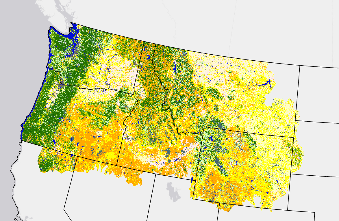
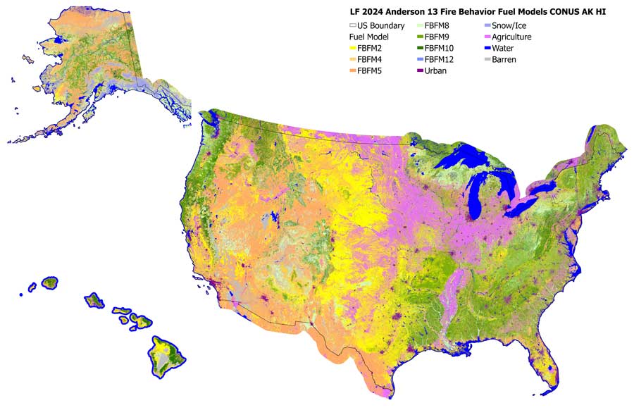
These original 13 standard fire behavior fuel models serve as input to Rothermel's surface fire behavior and spread model. LANDFIRE's (LF) 13 Anderson Fire Behavior Fuel Model (FBFM13) represents distinct distributions of fuel loading found among surface fuel components (live and dead), size classes, and fuel types. The fuel models are described by the most common fire-carrying fuel type (grass, brush, timber litter, or slash), loading and surface area-to-volume ratio by size class and component, fuelbed depth, and moisture of extinction.
FBFM13 was evaluated through a series of workshops held across the nation with fire and fuels specialists. Workshop participants reviewed and adjusted surface fuel model rulesets using unique combinations of Existing Vegetation Type (EVT), Existing Vegetation Cover (EVC), Existing Vegetation Height (EVH), and in some cases Biophysical Settings (BPS).
Annual Disturbance products were first incorporated into fuel production during LF 2008. The introduction of this information allowed for informed changes to the assigned fuel models from disturbance type, severity, and time since the disturbance.
LF 2016 Remap and beyond includes a 90-kilometer buffer along the 1,500 miles of the eastern and southern borders AK shares with Canada. Then with the LF 2020 update, and future updates, for the Conterminous United States (CONUS) a 90-kilometer buffer into Mexico is also included.
13 Anderson Fire Behavior Fuel Models Resources
A quick visual description of the expected fire behavior characteristics for surface fuel models.
- Wildfire Risk to Communities
- Compare fuel models spreadsheet - Joe Scott
- Updated - Compare fuel models spreadsheet - Joe Scott
- Fuel Models and Climate Labels
LF Definitions, Quality, and Standards - provides information about contributors, metadata and data standards, data creation, and data testing. This document also provides details about our general data release process.
LF Dictionary - a “one-stop shop” general resource that provides information about products, Attribute Data Dictionaries (ADDs), data and metadata, and terms.
LF Version Comparison Table - view the version history for each individual product.
LF Naming Conventions - understanding the version number