Latest News
LANDFIRE has been working hard to reduce the lag time in data, especially for mapped disturbance events. With the release of LF 2022 Update (LF 2022) products, annual disturbance data is now available that reflects disturbance events that occurred in calendar year 2021 and 2022.
LF DIST22
Tornado damage in Mayfield, Kentucky, on Friday. (Photo: NWS)
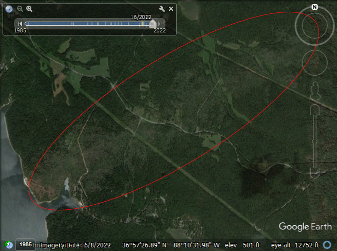
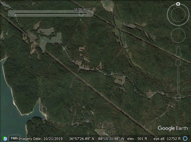
Using the LF 2022 CONUS Annual Disturbance 2022 (Dist22) product we can see the path (seen to the right as a white line) of the devastating tornadoes that ripped through Kentucky in late 2021. On December 10, 2021 an EF-4 tornado began in far northwest Tennessee and moved across western Kentucky, resulting in significant destruction to portions of the region. Dozens of tornadoes moved across nine states that night — Kentucky, Tennessee, Arkansas, Illinois, Missouri, Mississippi, Alabama, Indiana, and Ohio — including one historic "long track" tornado that stayed on the ground for more than two and a half hours.
On December 10, 2021, an EF-4 tornado began in far northwest Tennessee and moved across western Kentucky, resulting in significant destruction to portions of the region. The 2022 LF Disturbance data indicates this disturbance. Dozens of tornadoes moved across nine states that night — Kentucky, Tennessee, Arkansas, Illinois, Missouri, Mississippi, Alabama, Indiana and Ohio — including one historic "long track" tornado that stayed on the ground for more than two and a half hours.
Resources of this event:
2019
2022